连接
/
项目
持有者
活动
事件
项目
价格
数量
稀有度
自
至
时间
状态
全部
销售
铸造
转移
列表
项目报价
系列报价
特征报价
市场
销售
铸造
清除
事件
项目
价格
数量
稀有度
自
至
时间
特征
Feature
4
Detail
1
Biome
6
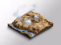
Terraforma Plots
Ethereum
45 unique
45
2021年8月
博彩
Ethereum
45 独特物品
45
启动 2021年8月
博彩
地板价
—
1d 楼 %
0%
最佳报价
—
24小时交易量
0
.
0
0
0.00
ETH
总交易量
4
.
2
5
4.25
ETH
已刊登
0
%
0%
所有者(唯一)
2
6
26
(
5
7
.
8
%
57.8%
)
Terraforma Plots
Terraforma Plots
Ethereum
45 unique
45
2021年8月
博彩
Ethereum
45 独特物品
45
启动 2021年8月
博彩
项目
报价
持有者
特征
活动
事件
项目
价格
数量
稀有度
自
至
时间
Terraforma Plots
Ethereum
45 unique
45
2021年8月
博彩
Ethereum
45 独特物品
45
启动 2021年8月
博彩
地板价
—
1d 楼 %
0%
最佳报价
—
24小时交易量
0
.
0
0
0.00
ETH
总交易量
4
.
2
5
4.25
ETH
已刊登
0
%
0%
所有者(唯一)
2
6
26
(
5
7
.
8
%
57.8%
)
Terraforma Plots
Terraforma Plots
Ethereum
45 unique
45
2021年8月
博彩
Ethereum
45 独特物品
45
启动 2021年8月
博彩
项目
报价
持有者
特征
活动
事件
项目
价格
数量
稀有度
自
至
时间
状态
全部
销售
铸造
转移
列表
项目报价
系列报价
特征报价
市场
特征
Feature
4
Detail
1
Biome
6
销售
铸造
清除
事件
项目
价格
数量
稀有度
自
至
时间
状态
全部
销售
铸造
转移
列表
项目报价
系列报价
特征报价
市场
特征
Feature
4
Detail
1
Biome
6
销售
铸造
清除
事件
项目
价格
数量
稀有度
自
至
时间
事件
项目
价格
数量
稀有度
自
至
时间
事件
项目
价格
数量
稀有度
自
至
时间
事件
项目
价格
数量
稀有度
自
至
时间
事件
项目
价格
数量
稀有度
自
至
时间
铸造
Kaghan Valley
—
1
#19
NullAddress
TerraformaPlots
铸造
Baja California Sur
—
1
#40
NullAddress
TerraformaPlots
铸造
Gobi Desert
—
1
#30
NullAddress
TerraformaPlots
铸造
Bermuda Triangle
—
1
#40
NullAddress
TerraformaPlots
铸造
Bering Strait
—
1
#23
NullAddress
TerraformaPlots
铸造
Bali
—
1
#40
NullAddress
TerraformaPlots
铸造
San Francisco
—
1
#33
NullAddress
TerraformaPlots
铸造
Greece
—
1
#40
NullAddress
TerraformaPlots
铸造
Bermuda Triangle
—
1
#40
NullAddress
TerraformaPlots
铸造
Vancouver
—
1
#33
NullAddress
TerraformaPlots
铸造
Los Angeles
—
1
#1
NullAddress
TerraformaPlots
铸造
Sicily
—
1
#9
NullAddress
TerraformaPlots
销售
London
0.035
ETH
1
#2
RipTheTides
TerraformaPlots
铸造
Nā Pali Coast
—
1
#7
NullAddress
TerraformaPlots
铸造
Lake Baikal
—
1
#7
NullAddress
TerraformaPlots
铸造
Uluru
—
1
#30
NullAddress
TerraformaPlots
铸造
North Korea
—
1
#33
NullAddress
TerraformaPlots
销售
Isle of Man
0.25
ETH
1
#3
TerraformaPlots
d12blessedup
销售
Grand Canyon National Park (East)
0.16
ETH
1
#5
RipTheTides
NeedMoreJPEGs
铸造
The Bahamas
—
1
#25
NullAddress
TerraformaPlots
销售
Grand Canyon National Park (East)
0.20
ETH
1
#5
BradThe3rd
RipTheTides