2
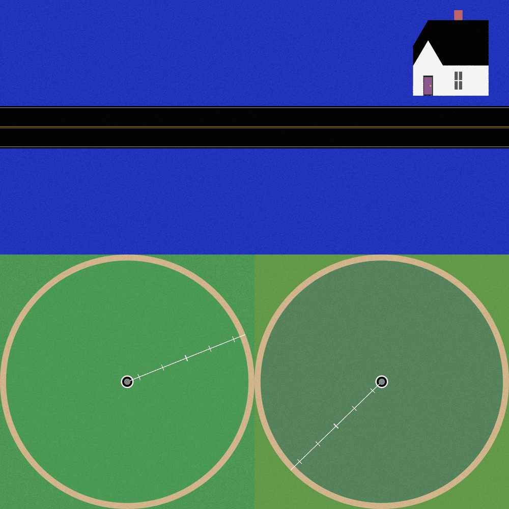
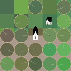
Theoretical Townships explores the tension between flatness and depth within aerial representations of landscape. The title references a well-known diagram, created in 1785, illustrating the method for numbering sections of a standard township survey. Mirroring the structure of this diagram, each output from Theoretical Townships is subdivided into a grid of sections, ranging from one to thirty-six. In addition to incorporating landscape elements, such as pivot irrigators, roads, and buildings, the code also overlays large blocks of color, which create associations with two-dimensional quilting patterns. Through this representational conflation of flatness and depth, the project reveals an inherent conflict between landscape and the grid: the former being an irregular, topographic continuum, and the latter operating as an abstract, geometrical device for measurement and control. Embedded within the tension between landscape and the grid is a complex set of relations regarding the history and politics of territorial expansion.
Theoretical Townships explores the tension between flatness and depth within aerial representations of landscape. The title references a well-known diagram, created in 1785, illustrating the method for numbering sections of a standard township survey. Mirroring the structure of this diagram, each output from Theoretical Townships is subdivided into a grid of sections, ranging from one to thirty-six. In addition to incorporating landscape elements, such as pivot irrigators, roads, and buildings, the code also overlays large blocks of color, which create associations with two-dimensional quilting patterns. Through this representational conflation of flatness and depth, the project reveals an inherent conflict between landscape and the grid: the former being an irregular, topographic continuum, and the latter operating as an abstract, geometrical device for measurement and control. Embedded within the tension between landscape and the grid is a complex set of relations regarding the history and politics of territorial expansion.