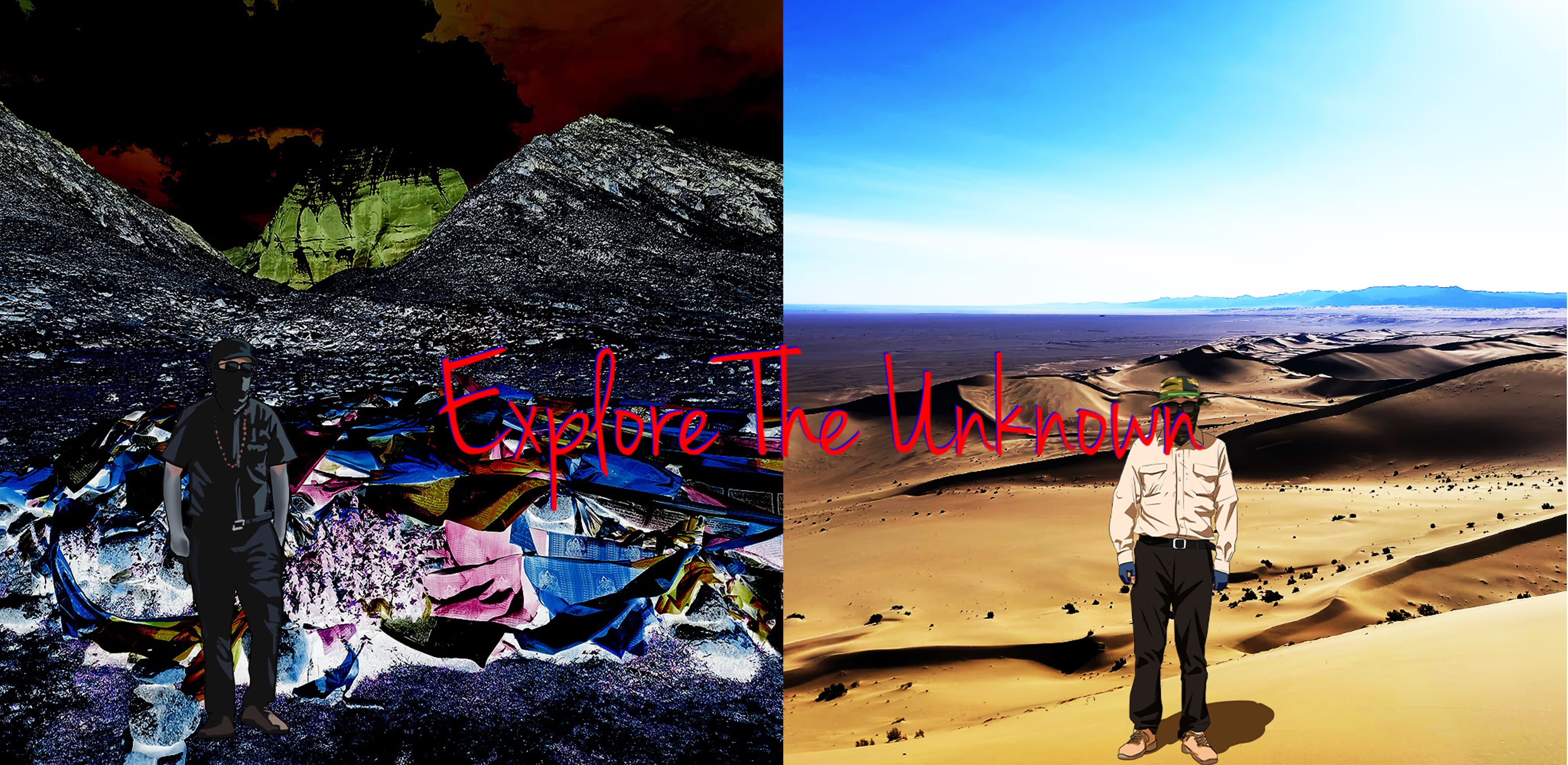
Lop Nur,forbidden zone to life,one of four no man’s Lands in Xinjiang autonomous region,China.It is known as “the ear of the earth”,and also known as"the sea of death".Lop Nur is also one of the eight forbidden zones to life in the world.
Lop Nur is located in the middle of the vast desert,tightly surrounded by desert dust,and there are often tornado attacks,desert subsidence,beast attack,almost waterless and so on.
It is a hostile place nicknamed Asia's Devil's Triangle. This unfriendly area has caused the deaths of hundreds of adventurers.
The first Chinese nuclear bomb occurred at Lop Nur on 16 October 1964.
Square measure:91,000 square kilometers.
No signal at Lop Nur.I spent 8 days to pass through this area.
Mysterious events and legends about Lop Nur:
1.Loulan ancient kingdom mysterious disappearance
Loulan kingdom suddenly disappeared from the area in the third century, leaving a wealth of enigmas for later generations.There are different views on why and how the city, once a booming trade center with a thriving trade in silk,glass and perfume,disappeared so suddenly at Lop Nur. In the vicinity of the ancient city, there were sites of houses, Buddist Pagoda, beacons, ancient tombs, etc. The dried female corpse found there was called “Loulan beauty...caused a sensation at home and abroad”.
2.Mirror People legend
In the 1960s a group of wandering sand people were found in Lop Nur who seemed to be mentally ill and excited but soon died, and the dissection found that a plant with a toxin was found in their stomachs, and the organs in these people were mirrored by normal people.Therefore, investigating the origin of these people and finding the plant became the first priority, and several investigations failed to find it.
3.Alien Base There are many suspected UFO pictures took at Xinjiang Uygur Autonomous Region.Lop Nur is in Xinjiang Uygur Autonomous Region either, and photography location is close to Lop Nur. Presumably,Lop Nur may has alien base.

4.Pisces jade pendant legend at Lop Nur
It is said that the Pisces jade pendant is not the kind of real jade pendant we imagined, but because it is said that someone once successfully copied two identical fish,and the two fish can swim completely independently:but if one of the fish is poisoned, the other fish will die in seven hours. Mirror people event may relate to pisces jade pendant.Pisces jade pendant is time machines or material transfer devices of superhuman civilization.It may involve alien civilization.
5.Mysteriously missing great scientist
Peng Jiamu was a great scientist and explorer who vanished during an expedition Lop Nur, the "Wandering Lake."
It is a hostile place nicknamed Asia's Devil's Triangle. This unfriendly area has caused the deaths of thousands of people.
In 1980 Peng led a team of biologists, geologists, and archeologists to Lop Nor to conduct new research.On June 17, several days into the journey, he abruptly disappeared from his camp after leaving a note saying he was going out to find water.He never came back again.

6.Time travel at Lop Nur,the missing great scientist soul wear emperor Wang Mang, revitalize reform?
Wang Mang, an ancient China emperor 2000 years ago. The first item of emperor Wang Mang's drastic reforms is the land system, which states all fields and does not allow private purchases of land. This policy, and the state-owned land system implemented by the country in the early days of the founding of Peng Jiamu, can be said to be carved out of the same mold. Coincidentally, in the New Deal, Wang Mang also proposed important measures such as the prohibition of the trading of slaves, five equals and six management, which are very similar to the market planned economy policy initiated in the early days of the founding of the People's Republic of China and the concept of equality for all. As a vested interest in private ownership and slave ownership, Wang Mang was a son of a noble family. In the social environment at that time, it was incredible to be able to propose such reform measures. And other than that, the bronze calipers of Wang Mang found in Wang Mang's tomb are exactly the same as the current vernier calipers. Therefore, many people are more convinced that Wang Mang is Peng Jiamu who traveled through.
You know, at that time when Wang Mang lived, it was not easy to produce such an accurate caliper. But if a scientist like Peng Jiamu traveled back to ancient times to make a caliper with such precision, it sounds more logical.
Everyone knows that the oppression of women by the ancient feudal dynasties was quite serious. But under the fetters of such feudal thoughts, Wang Mang let his wife go out to welcome guests in a short skirt! How could an ancient person have such an advanced and avant-garde thinking? This has naturally become a major theoretical support point of the "traversal theory". Moreover, after Peng Jiamu's disappearance, the team members found that Peng Jiamu not only took away some essential items, but also took away a copy of precious materials. If Peng Jiamu really just followed the message on the note to find the source of water eastward, why did he take a copy of the information? And what is recorded in this precious material? Is it possible that this material was prepared by Peng Jiamu in advance for the crossing?
Abode of Lord Shiva and the source of the Brahmaputra, Indus, Sutlej, and Karnali rivers, Mount Kailash is the sanctum sanctorum that is referred to as the centre of the world and the stairway to heaven. The supremely sacred mountain is situated in the southwestern part of Tibet,China, bordering the Kumaon region of India - the point where heaven meets earth.
Like it’s said, “Universe is under no obligation to make sense to humans.” Sometimes we have to believe in the unbelievable; that is when we surrender to the supreme. Mount Kailash is one such place on earth that has been universally accepted as divine for many reasons.
I hallucinated when I closed to Mount kailash, and hallucination disappeared when I went back.

The Mysteries Of Mount Kailash:
1.Significance Of Mount Kailash In Different Religions
Considered Sanctum Sanctorum of Hindus, Buddhists, Jains, and Bon religion, Mount Kailash is revered by all. Hindus worship Kailash as an abode of Shiva. Tibetan Buddhists consider it a representation of Buddhist cosmology on the earth. For Jains, the place holds significance as the founder of their religion, Rishabh, attained spiritual awakening here. Boms believe that their founder landed at Kailash when he descended from heaven. No matter how different religions find their spiritual connection with Mount Kailash, the core essence is that the precious snow mountain is universally accepted as DIVINE.
2.Discovered As The Center Of The World
According to the research of various scientists, it has been stated that Mount Kailash is the axis of rotation of the celestial sphere. Having mentioned in Vedas and mythological book, Ramayana, Kailash Parvat has also been scientifically discovered as the axis Mundi. Various studies have proven that the quintessential divine peak is the centre of the world and is connected to significant monuments around the globe. The historic landmark in England, Stonehenge, is 6666 km away from here. The same dimension goes with the North Pole, which is also 6666 km from the Mount and the distance doubles exactly with the South Pole, which is exactly 13332 km away from the peak.
3.No Human Could Ever Climb To The Peak
No Many daring mountaineers have attempted to make their way to the peak of Kailash Parvat, but no one could ever make it to the abode of Shiva. According to Hindu scriptures, meddling with the divinity of the sacred Mount is a forbidden act as this can disturb the Godhead, Lord Shiva Kailash, who resides in the mountain with his consort and Nandi. With the record of unsuccessful attempts at the summit, Mount Kailash remained unexplored to date. Rough weather, altitude sickness, diverging in the wrong direction, and misleading trails are some hindrances that deter even the toughest trekkers. Something strange happened to climbers. For example, In 1999, 4 climbers tried to climb the mount. These 4 climbers grow old quickly in 2 years, and 2 of them passed away in 2 years.
4.Taking A Leap Into Time
Another astounding fact of Lord Shiva’s Kailash is time travelling which suggests that the air in the mountain renders to the rapid ageing process. This transtemporal travel claim is backed by a story of climbers from Siberia. After trespassing the forbidden line, the group of climbers experienced ageing by a few decades. All these climbers died within a year's time due to the leap of age. This in itself raises curiosity and leaves us in bewilderment. Also, trekkers and pilgrims who visit Kailash Parvat say that they have noticed a rapid growth of the nails and hair while trekking and even after returning from the holy mountain. Whether people believe this or not, the gospel truth can be witnessed in the growth that happens in weeks in hours at Kailash. That’s real-time travelling, right?
5.The Uncanny Resemblance Of The Lakes With Sun And Moon
Home to two holy lakes, Mansarovar and Rakshas Tal, these two pristine lakes are located at the foot of Mount Kailash. The sight to behold! One can witness the extraordinary creation of God. The highest freshwater lake in the world, Mansarovar holds deep spiritual significance owing to the holiness and shape that resembles the sun, while Rakshas Tal is believed to have emerged out of Ravana’s intense austerities to please Lord Shiva and is endowed with salty water and resembles the crescent moon. Both the lakes personify the light and dark, the positive and the negative energies that envelop the earth. Every year, many devotees pilgrimage to Mansarovar believed to release them from sins and cure them of diseases.
6.The Pyramid Shaped Mount Looks Unnatural
For centuries, the pyramid-shaped Mount Kailash has captivated many scientists for research on the mystifying secrets wrapped around like a thick layer of snow. One theory by Russian scientists suggests that Mount Kailash is way too perfect in terms of symmetry, shape, and size that it barely appears to be carved out of the natural occurrence. The other scientists say that the Mount has striking similarities with a pyramid or cathedral of Egypt.
7.World War II Germany dispatch a research team to seek mysterious power.
Mount Everest (Qomolangma) is Earth's highest mountain above sea level, located in the Mahalangur Himal sub-range of the Himalayas. The China–Nepal border runs across its summit point. Its elevation (snow height) of 8,848.86 m (29,031 ft 8+1⁄2 in) was most recently established in 2020 by the Chinese and Nepali authorities.
Geologists have subdivided the rocks comprising Mount Everest into three units called formations. Each formation is separated from the other by low-angle faults, called detachments, along which they have been thrust southward over each other. From the summit of Mount Everest to its base these rock units are the Qomolangma Formation, the North Col Formation, and the Rongbuk Formation.

Kanas Lake is a lake in Altay Prefecture,Xinjiang,China.The lake is located in a valley in the Altai Mountains, near the very northern tip of Xinjiang and the autonomous region's borders with Russia, Kazakhstan and Mongolia. The lake was formed around 200,000 years ago during the Quaternary period as a result of glacier movement. The crescent moon shaped lake has an estimated water storage capacity of 53.8 billion cubic meters, coupled with an average depth of around 120 meters.
The Mystery of Water Monsters:
For several centuries there have been sightings of large lake monster in the waters. First efforts in research of these legends were done by Yuan Guoying of Xinjiang University, who observed fish of enormous size in 1985. He and his students assessed that the fish could be 10 – 15 m long and weigh more than 4 tons, with total population in excess of 50 individuals.
Frequency of observation has increased in the 21st century, with the development of mass tourism. A video was taken and shown in the local Chinese media where numerous unidentifiable creatures can be seen.
The Sepu Kamiyama is a mountain in Biru County, Nagqu prefecture, Tibet Autonomous Region. The mountain is 285 kilometres (177 mi) east-northeast of Lhasa and 178 kilometres (111 mi) east-southeast of Nagqu Town. With a height of 6,956 metres (22,822 ft), it forms the highest point in the eastern part of the Nyenchen Tanglha Mountains. The full name of the mountain is Sepu Kunglha Karpo, meaning "white snow god".
The mountain is sacred in Tibetan Bon tradition. The mountain is referred to as in that context.There is a Bon monastery that is more than half millennium old in the valley below.
Chang Tang lies in the northern Tibetan Plateau. It is the largest no man's land in the world, after the Northeast Greenland National Park and Kavango-Zambezi Transfrontier Conservation Area, with an area of over 334,000 km2 (129,000 sq mi),making it bigger than 183 countries. Administratively, it lies in Xainza County and Biru County of the Nagqu Prefecture. With the more recently established adjoining reserves listed below there is now a total of 496,000 km2 (191,507 sq. miles) of connected Nature Reserves, which represents an area almost as large as Spain and bigger than 197 other countries.
With elevations ranging from 4,300 to 7,000 m, the climate in Changtang is extremely cold and arid, yet it contains a wealth of unique and endangered wildlife. Habitat species include chiru, snow leopards, Tibetan wild ass (kiang), along with Tibetan brown bears, blue sheeps, Tibetan sand foxes, black-necked cranes, and wild yaks.
No signal at Changtang No Man’s Land. I spent 14 days to pass through this area.
The mystery of the Heaven's Gate in Chang Tang:
The heaven’s gate in Chang Tang,various numerous wild animals are attracted by a mysterious force,make long and difficult journey,to the Heaven’s Gate to wait quietly for death.Currently, science can not explain.
For example,I saw a dying wild yak,eyes covered in tears,staggered towards death.
At heaven’s gate, there is no law of the jungle,all kinds of animals get along well,silently waiting together for the life last moment to come.
Guge was an ancient dynastic kingdom in Western Tibet. The kingdom was centered in present-day Zanda County, Ngari Prefecture, Tibet Autonomous Region. At various points in history after the 10th century AD, the kingdom held sway over a vast area including south-eastern Zanskar, upper Kinnaur district, and Spiti Valley, either by conquest or as tributaries. The ruins of the former capital of the Guge kingdom are located at Tsaparang in the Sutlej valley, not far from Mount Kailash and 1,200 miles (1,900 km) west from Lhasa.
The disappearing of Guge Kingdom is considered as one of the top uncovered mysteries of Tibet. How did Guge Kingdom disappear overnight? How a kingdom with rich and well-developed culture disappeared so suddenly and completely like the ancient Mayan civilization?
North Korea, also called the ''hermit kingdom,'' is the most isolated and secretive country in the world.
The roughly 24 million people who live in the totalitarian state have minimal interaction with the outside world. Foreign media is forbidden, interaction with tourists is strictly controlled and the Internet is inaccessible to almost everyone.
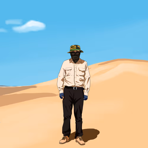
I have strong desire to deeply know the most isolated and secretive country. When I visited North Korea, I tried to wear formal cloth to look like a local to touch North Korea people real life because most of locals wear formal clothes either. Unfortunately,my image not look like a local even I wear formal cloth. My whole trip in North Korea was accompanied by 3 local tour guides. Tourists were not allowed to touch local people without accompany with local tour guides. The only chance I had to touch locals is to touch tour guides, government or military officials who they allowed, so I seized all opportunities as much as possible to touch them to know more North Korea.
Demilitarized Zone (North Korea Side)
The Korean Demilitarized Zone is a strip of land running across the Korean Peninsula near the 38th parallel north. The demilitarized zone (DMZ) is a border barrier that divides the peninsula roughly in half. It was established to serve as a buffer zone between the countries of North Korea and South Korea under the provisions of the Korean Armistice Agreement in 1953, an agreement between North Korea, China, and the United Nations Command.
YX is in block chain industry since January 2018,and he is absorbed in exploring the unknown.He is a fanatical adventurer,challenging the limits.He has strong sense of curiosity in various types of unknown domains,and he sets goals to explore various mysterious areas at different stages of life.
YX is in block chain industry since January 2018,and he is absorbed in exploring the unknown.He is a fanatical adventurer,challenging the limits.He has strong sense of curiosity in various types of unknown domains,and he sets goals to explore various mysterious areas at different stages of life.

Magical 30 degrees north latitude 30°N is known as the "Ring of God".30°N is such a zone on earth,where countless mysterious events occur. We selects 5 mysterious areas from 30°N to explore lately, including the Hanging Gardens of Babylon, Mayan civilization, U.S Death Valley, Devil's Triangle Poyang Lake, The Sanxingdui Ruins, and Bermuda Triangle. We plan to make NFTs based on firsthand experience of these 5 areas, and expects to go live on 04/2024.Some locations may change based on actual situation.
Magical 30 degrees north latitude 30°N is known as the "Ring of God".30°N is such a zone on earth,where countless mysterious events occur. We selects 5 mysterious areas from 30°N to explore lately, including the Hanging Gardens of Babylon, Mayan civilization, U.S Death Valley, Devil's Triangle Poyang Lake, The Sanxingdui Ruins, and Bermuda Triangle. We plan to make NFTs based on firsthand experience of these 5 areas, and expects to go live on 04/2024.Some locations may change based on actual situation.